AlbarOil Geoscience Services
Leveraging on the combined vast experience of our Geoscience team, we could offer our consultation services as in assisting Oil Companies to achieve its goal by recommending the following:
Geoscience Services
Geoscience services encompass a range of scientific disciplines focused on understanding the Earth's structure, processes, and resources. These services include geological surveys, environmental assessments, natural resource exploration, and hazard mitigation, supporting industries such as mining, oil and gas, construction, and environmental management by providing critical data and analysis for informed decision-making.
Survey Activities
-
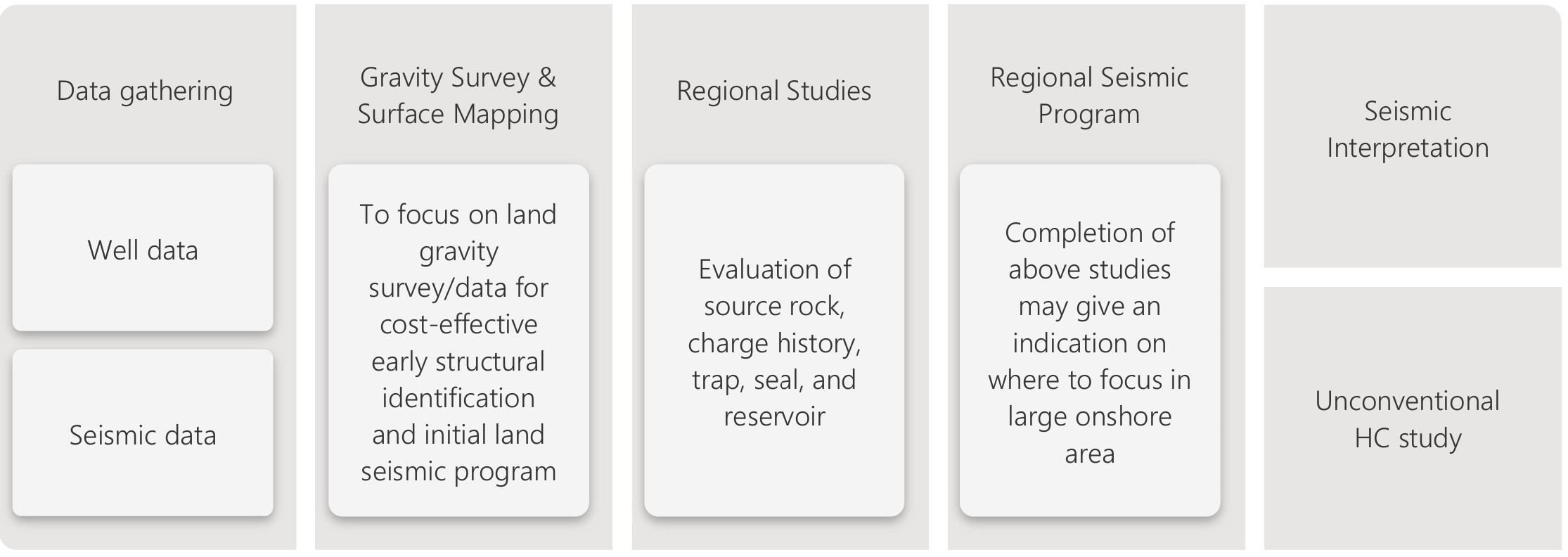
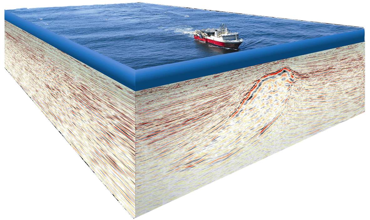
Seismic – Onshore and Offshore
Land Gravity
Surface and Subsurface Mapping
Geochem Sampling/Core Description & Rock Analysis
-
Our modern geological laboratory integrates field and laboratory analysis with wider geological characterization and interpretation.
Derisking the petroleum focus in onshore Sarawak and map the presence and distribution of hydrocarbon habitat. An insight into the exploration potential in onshore Sarawak
Geoscience Training Courses
-
Developing local talents for oil and gas industry capabilities by combining training from the expert, in house class training, field trip and lab courses that provide hands-on learning experiences
Apply and implement industry knowledge and experience for our training which include case studies, group discussion, scenarios, simulation, practical exercise, and knowledge assessments during the course.
Unconventional Hydrocarbon
-
Hydrocarbon originated from shale, tight sand, coalbed, and hydrates.
Potential area in onshore Sarawak includes Mukah with the presence of abundance coal beds
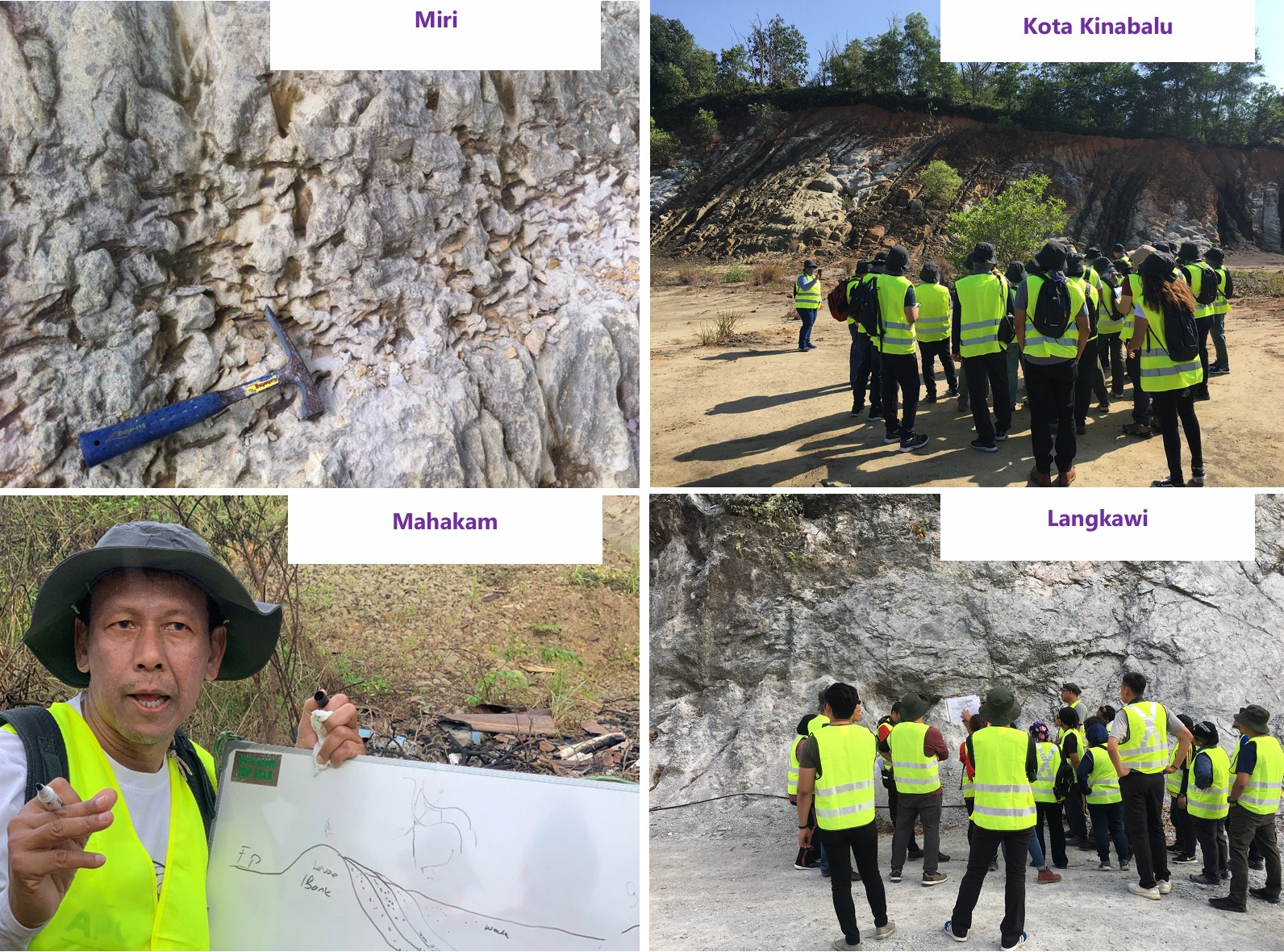
G&G Studies, Fieldtrip
-
With limited seismic coverage in the onshore area, regional study will provide a base of geological understanding of the area about the rock distribution, characteristic and age relationship essential in prospecting hydrocarbon play.
The above derisking method and the mapping of the presence and distribution of hydrocarbon habitat will give us the insight into the exploration potential for the frontier area
Onshore Survey Services
We offer a comprehensive study which covers all aspects of Geophysical Survey, Geological Terrain Mapping and Geological Mapping, Geographic Information System Integrated with IT (GIS-IT), Underground Utilities Mapping, Geo-Tourism Consultancy, Mining Exploration, Geotechnical Consultant/Forensic, and Details Engineering Topography Survey Using UAV LiDAR & Aerial Photo.
Exploration Geophysical Survey
-
Resistivity & RES-IP survey, seismic survey, electromagnetic, etc.
Our specialties include data acquisition, analysis, and interpretation of data.
Capable to analyze data to 2D and 3D using RES2DIV and VOXLER software.
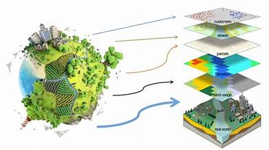
Geographic Information System Integrated with IT (GIS-IT)
-
Specialized in GIS with experienced manpower and modern software to provide consultancy for Planning Permission (KM), Slope Information, 3D Model, Early Warning System and Asset Management
Using Software ArcGIS Desktop to perform any GIS task, simple to advance including mapping, geographic analysis, data editing and compilation, data management, visualization, and geo-processing
Geological Terrain Mapping and Geological Mapping
-
We are capable to produce geological terrain classification which covered erosion map, physical constraints map, terrain map and construction stability map.
Geological Mapping involves the condition of the geology of the area and their geomorphology
Underground Utilities Mapping
-
We provide integrated solution for locating and mapping of underground utilities. Combining reliability and convenience of Ground Penetrating Radar and the versatility of Radio Detection Technology. Combined both applications will be able to locate power line, water pipe, telecommunication line, fuel, and gas pipes, etc.
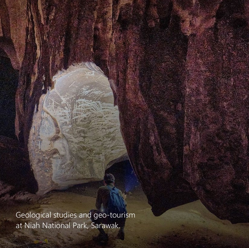
Geo-Tourism Consultancy
-
Provide consultation in Geo-Tourism which Geo-Tourism consultant encompasses mapping and geological heritage with value added in the specific area and cultural details of the evaluation and rating of geo-sites and socio- economic area
Geotechnical Consultant/Forensic
-
Analyses of project, site conditions or construction from a geotechnical standpoint.
-
Perform during the design phase of a project to check the calculation and engineering assumptions or during and/or after the construction of a project to provide quality assurance or address issues that arise during or after construction.
Mining Exploration
Specialties in gold mining, iron ore, rare earth elements. Previous projects include:
The prospecting and Evaluation at Bertam, Gua Musang, Kelantan.
Iron ore exploration at Kg. Melaka, Kuala Lipis using Magnetic Survey.
Iron Ore Potential & Exploration at Temangan and Macang, Kelantan using Magnetic Survey
Geological Studies for Specific Rare Earth Element, Lanthanum (𝐿𝐿𝐿𝐿57) and Cerium (𝐶𝐶𝐶𝐶58) on Plot A (25.98HA) and Plot B (14.49HA), Mukim Hulu Jelai, Daerah Lipis, Negeri Pahang Darul Makmur.
Details Engineering Topography Survey Using UAV LiDAR & Aerial Photo
-
Using eBee Sensefly which is very compact in size (similar to drone size), able to capture high resolution image and manage to cover up 12 sq km in single automated mapping flight.
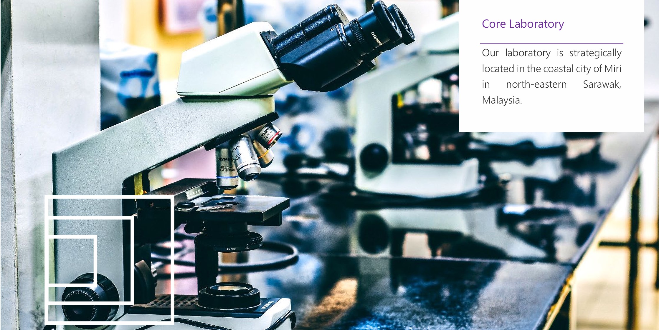
Reservoir Characterization and Laboratory
Our Core Laboratory provides a suite of laboratory services that focus on reservoir rock analyses. Supported by local expertise and rigorous quality check processes, our personnel are experienced in delivering Routine Core Analysis (RCA) and Special Core Analyses (SCAL) and G&G analyses, including Sedimentology, Biostratigraphy and Geochemistry.
Routine Core Analysis
Locally, the routine core analysis is performed by our in-house experienced personnel. Services offered include but not limited to the following:
Core preparation
Plug trimming
Core gamma
Plug cleaning & drying
CT scan
Porosity
Core slabbing
Permeability
Core preservation
Grain density
Digital image photography
Fluid saturation
Core storage
Residual fluids saturations
Viewing room
Porewater salinity
Drilling and mounting
Grain size analysis
Geological Laboratory Analysis
Our modern geological laboratory integrates field and laboratory analysis with wider geological characterization and interpretation. Services include:
-
Sedimentology Analysis
Thin section
Petrography
Fluid Inclusion studies
XRD & XRF analysis
Core description
SEM analysis
-
Geochemistry Analysis
HC Migration
Source Rock Analysis
Maturation & Kerogen Analysis
Oil Analysis
Reservoir Geochemistry
-
Biostratigraphy Analysis
Micropalaeontology
Palynology
Nanopalaeontology
Microfacies
Palynofacies
Wellsite Biostratigraphy
Special Core Analysis
Our competent experts provide special core analysis services to meet the end objectives of the clients. Services included but not limited to the following:
Formation resistivity factor
Resistivity index
Relative permeability
Capillary pressure
Porous plate
Cation exchange capacity
Centrifuge six-point curve
Mercury injection
NMR analysis
Thermal properties
Wettability measurement
Capillary pressure
Geomechanics Analysis
Better understand your reservoir behavior and the mechanical changes associate with completion and production by leveraging advance geomechanics technology.
Uniaxial & triaxial compression testing
Multistage triaxial testing
Fracture toughness
Mohr envelope analysis & construction
Hydraulic fractures design
Pore volume compressibility
Natural fracture conductivity
Borehole stability analysis
Thick-walled cylinder test
Advanced Thick-Walled Cylinder Test
Brazil Tensile Strength Test
Scratch Test
Digital Core Analysis
We provide a very quick and robust complementary alternative for the optimized investigation of EOR options, especially where conventional core analysis investigations are limited due to time constraints or due to status of the core material.
Micro-CT imaging on regular cylindrical plugs ("dry" or native state)
Pore & grain partitioning
Micro-CT imaging ("wet" state)
Sample preparation
SEM and SEM-EDS analysis
Micro-CT imaging on fragments/cuttings/ unconsolidated material
Digital petrophysical properties
Digital multiphase flow analysis
Multiphase flow analysis
Upscaling
Wellsite Services
Our personnel are experienced in core preservation at the wellsite to ensure the samples are handled and preserved correctly. In addition, our personnel have experienced managing consolidated samples and unconsolidated core samples – the more challenging type of sample to handle
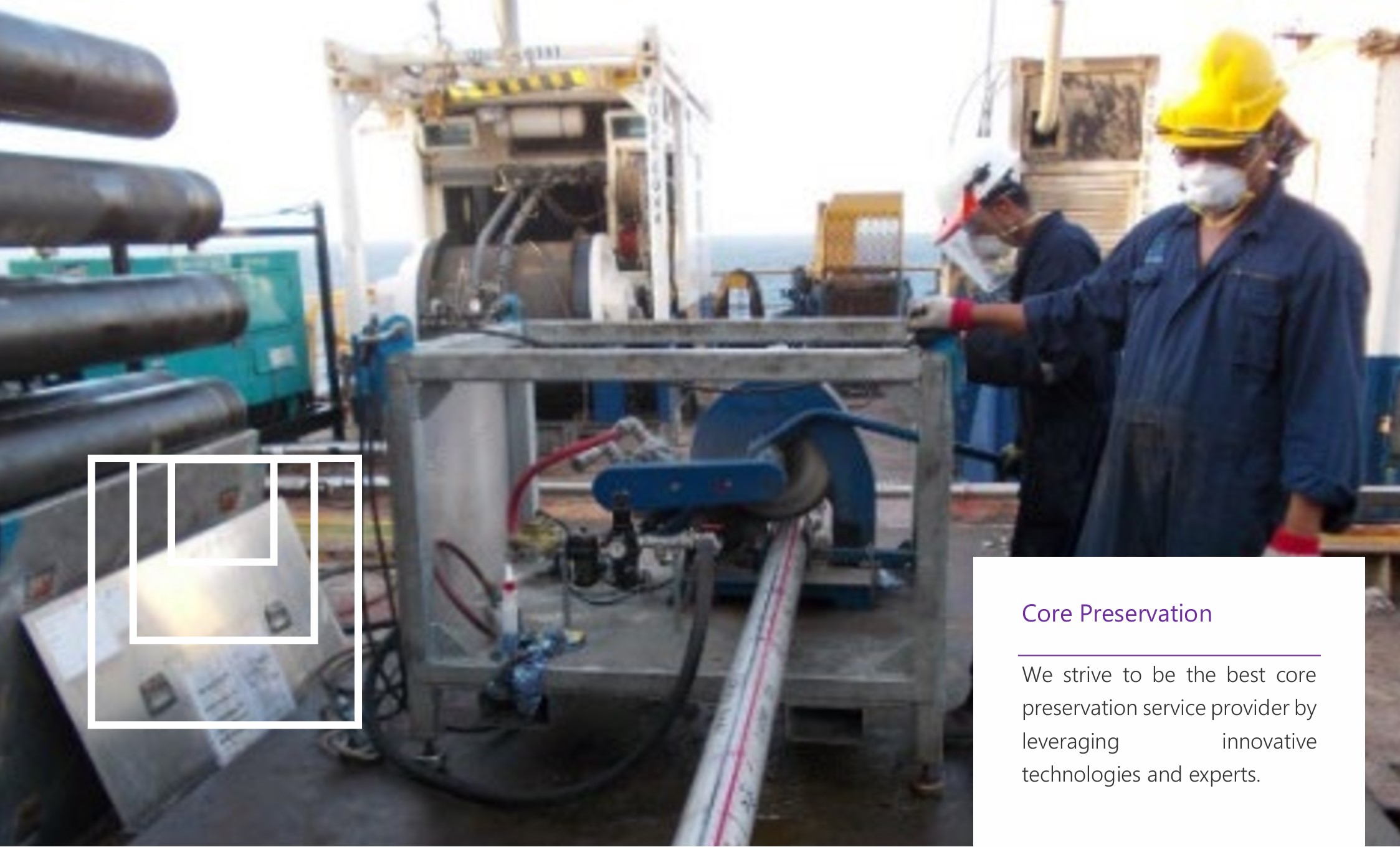
We believe reliable laboratory data comes from the excellent practice of core preservation at the wellsite. That is why our personnel receive constant training, either at the laboratory or on-job training.
Wellsite Core Handling
Our wellsite core handling also includes:
Onsite plugging and slabbing.
Core section preservation using wax.
Shock tagging
Transportation to client's site with the supervision
Handling Consolidated Samples
For consolidated samples, resin or foam are used for core preservation and stabilization. The choice depends on the decision made by our core preservation experts together with the clients. As for unconsolidated samples, dry ice and liquid nitrogen are more suitable to preserve the core. Cores are frozen until they reach below -60 degrees Celsius before being packed and transported in special containers.
We also perform preservation of unconsolidated core by using liquid nitrogen. The advantage of using liquid nitrogen is that it minimizes the damage caused by the ice. In addition, with its quicker freezing time, the growth of ice crystal could be reduced.